We are collecting this information as an important step to better understand our wild neighbours. It will help us determine how best to mitigate human-wildlife conflicts. It will be used to tailor our awareness, inform education programming and advocate for planning and policies best suited to our area.
So, how do we map wildlife and their movements?
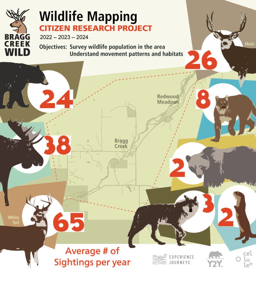
A citizen-research project. Shortly after Bragg Creek Wild was formed, a key initiative was launched to collect wildlife sighting data. This was set up to help substantiate our mission to improve human-wildlife interactions by understanding, to some degree, what residents of Bragg Creek have seen.
Since the inception of this wildlife sighting initiative in January 2021, the team at Bragg Creek Wild set up a simpler way to submit observations on their website. This Google form was live in 2022, and in the current version, over 350 observations have been added, reported largely by citizens in the greater Bragg Creek area.
The raw data will then be used to create visual analytical tools such as heat maps showing ranges or frequency maps showing the number of road crossings. These analyses may be used as inputs to the development of informative signage, targeted speed limit reductions, and passing zones. Individual data will not be released to protect the species.
The form is easy to use and can be bookmarked on your phone for quick entries as you travel around the area.